
EARLY SETTLERS
Easton Royal lies at the eastern end of the Vale of Pewsey, immediately north of the great chalk plateau of Salisbury Plain and on a floor of upper greensand, a fertile sedimentary deposit originally formed in shallow marine conditions. Easton Hill and Easton Clump rise to a height of 240 metres above the south side of the village providing a stunning backdrop of glorious Wiltshire countryside.
Easton Hill is flanked by steep slopes leading down to dry valleys which appear to have been used as routeways for some considerable time - on the west to Milton Lilbourne, Clench Common and Martinsell, and on the east to Easton Royal, Ram Alley and Savernake. The steep sides of Easton Hill feature linear ditches situated just below the crest of the hill which run for almost its entire length. The flattish summit of the hill shows a series of field systems, and its sides were also cultivated with a number of small lynchets still apparent on the western slopes.
The northern end of Easton Hill is delineated by the heart-shaped enclosure of Easton Clump of the late pre-historic period. The two earthworks are unusually laid out in opposing arcs to form a possible ‘entrance’ from the north east. When first constructed, the bank and ditch must have been very obvious to observers on the lower ground towards Burbage, making it possible that the earthworks were laid out as an attention focussing device for whatever activity was taking place, on or around, the summit of Easton Hill.
In 1985, Esso Petroleum Company Limited built the Midline Pipeline to connect its refinery near Southampton with another pipeline and oil terminals in the Midlands. This project involved digging a trench 130 miles long, passing through the eastern boundary of Easton Royal.
At the planning stage, Esso had to take many considerations into account. One of the most important was to minimise the impact not only on communities, but also on the environment and national heritage of the five counties through which the pipeline passed.
After consultation with local authorities, it became clear that the project offered a remarkable opportunity to carry out an archaeological ‘dig’ crossing right through the English heartland. Esso agreed to engage the Trust for Wessex Archaeology as consultants working with the construction team to monitor any artefacts found and record their positions for more detailed investigation
Previous archaeological activity on Easton Hill and Easton Clump had shown evidence of an Iron Age settlement. A possible Bronze Age barrow, scatters of Roman pottery and an early medieval burial had been excavated near the hilltop. In addition, aerial photography has shown this area to have been well utilised in the past.
The pipeline was routed to the east of Easton Clump to avoid the area of most archaeological activity, only to reveal after topsoil stripping, an extraordinary series of pits and ditches. Over a distance of 90 metres, twenty pits and two rectangular features were uncovered lying between two shallow U-shaped ditches. Many of the pits appeared sharply defined as dark circles in the bright chalk bedrock.
A large quantity of finds was recovered. Most of the pottery seemed to date from early Iron Age around 600 BC. There were a number of flint tools and part of a saddle quern used for grinding corn. Two delicate bone objects were found, a needle and a ring. No postholes indicating the existence of buildings or structures were discovered, but burnt clay or daub was recovered which may be all that survives of the wattle and daub infilling for timber-framed buildings.
Even so, the discovery of positively dated archaeological features makes the existence of an extensive early Iron Age settlement or farmstead on Easton Down virtually certain.
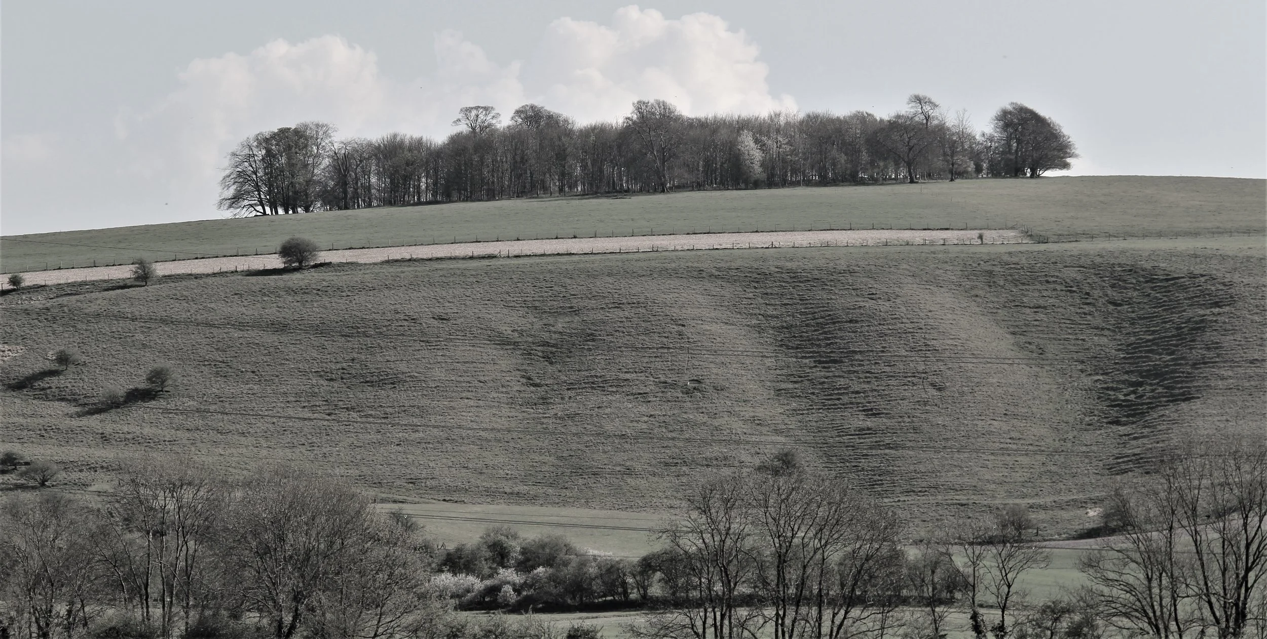
Easton Clump showing earthworks
Map of pipeline
Archaeological finds